Surveying services
Collecting, processing, and analyzing geospatial data are input parameters for creating surveying bases and information for the development of various projects in architecture, construction, etc.
Services we offer in area of Surveying services
We offer more then 10 different services in area of Geodesy

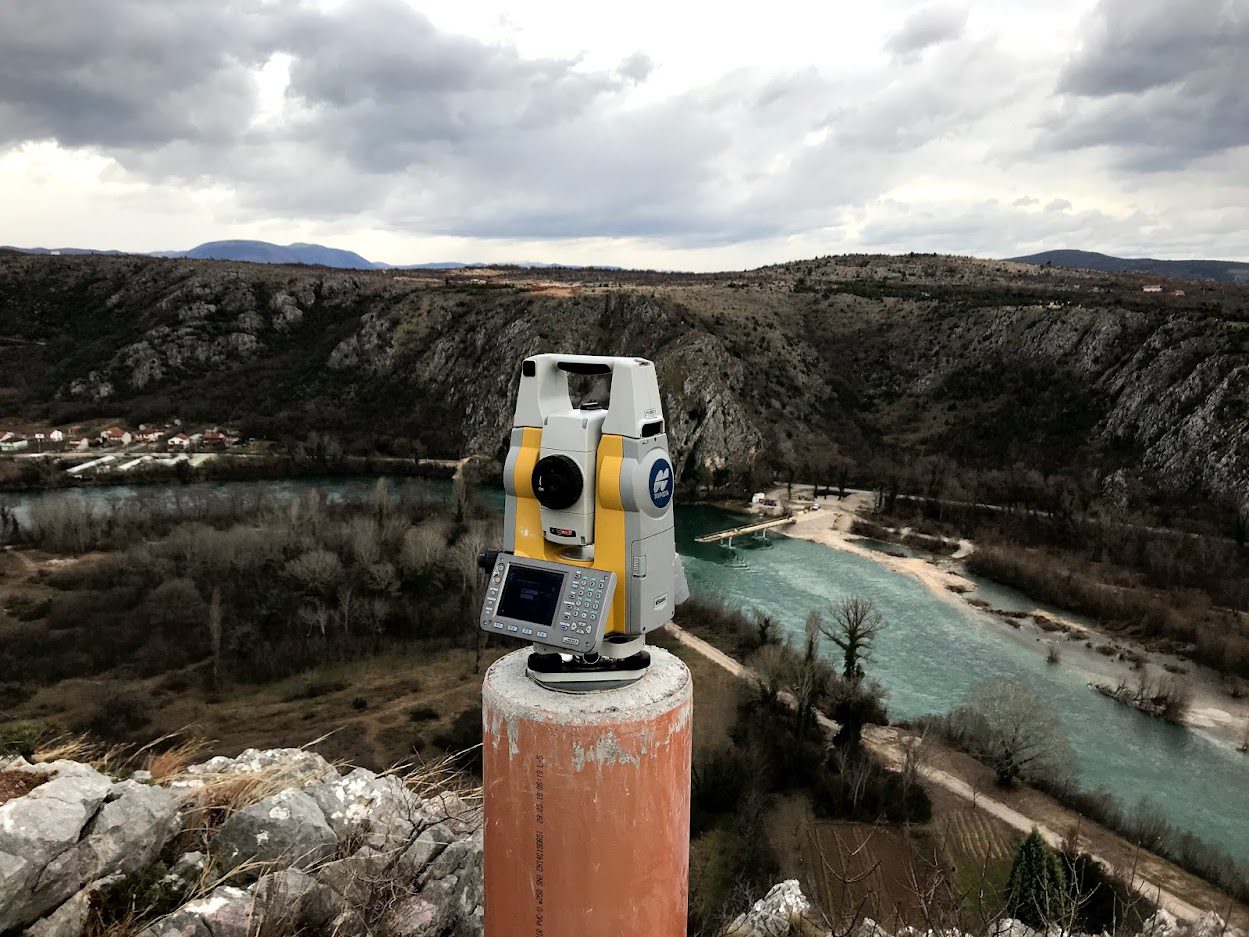
Establishment and renewal of geodetic networks
The establishment of a network of permanent geodetic points is a fundamental prerequisite for the successful execution of any construction project. The reliability and accuracy of the network of permanent geodetic points guarantee the successful implementation of the construction project in the field.

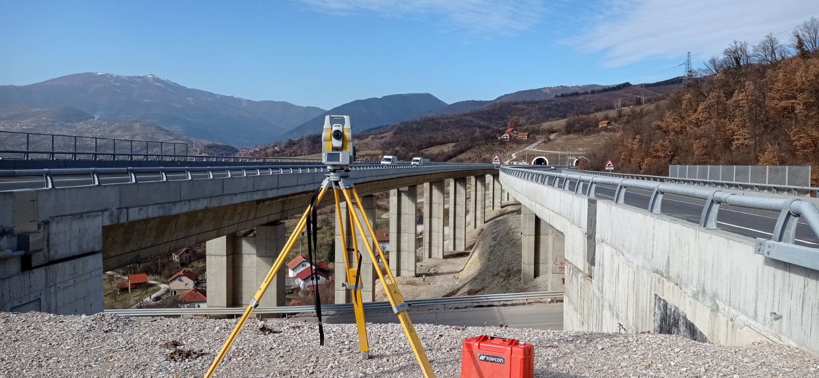
Tasks of geodetic supervision
During construction, it is of great importance to perform timely control of the correctness of the contractor's work, specifically verifying the compliance of the work with the project.

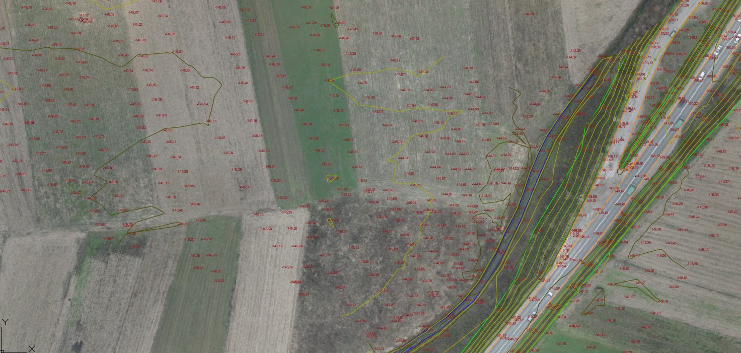
Measurement and determination of volume mass
Volume mass calculation is the process of determining the volume from a digital terrain model, applied in various fields such as quarries, earthworks, landfills, and other construction works.

Measurement and determination of displacements and deformations
As a result of external and internal influences such as wind forces, temperature changes, tectonic and seismic impacts, changes in groundwater levels, static and dynamic loads on structures, etc., there are shifts and deformations in objects. Through geodetic measurements and data analysis, we determine the direction and intensity of deformations.

Laser scanning is the fastest and most precise method of data collection for obtaining 3D data
Existing CAD documentation can be transformed into BIM technology.

Laser scanning
Laser scanning is the fastest and most accurate method for collecting data to obtain 3D information

Preparation of expropriation reports
An expropriation report represents a fundamental document for the preparation and implementation of the expropriation process. According to the Expropriation Law, the expropriation report includes a geodetic-cadastral plan of the expropriation area, information about properties (including owner identification), the purpose of expropriation, and other relevant data.

Staking out the object and geodetic monitoring of the construction process
Laser scanning provides us with comprehensive information about the existing condition of the object. By generating 2D drawings, we provide initial information for projects.

Industrial surveying
Setting out the position and dimensions of facilities, elements within facilities, facility assembly, foundation marks, crane paths, or transferring their designed dimensions and positions to the field within plants, factories, and production halls are just some of the specific surveying tasks that need to be addressed with the required precision in highly complex and non-standard conditions for construction works.
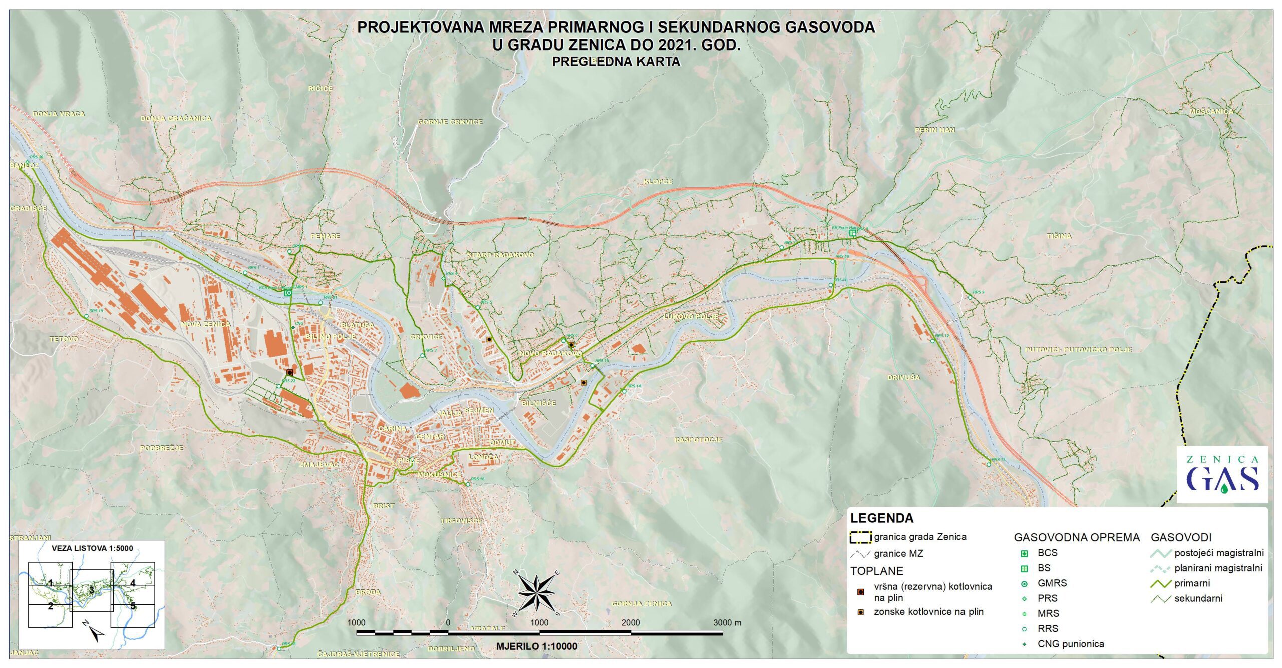
GIS
GIS encompasses cartography, remote sensing from satellite imagery, terrain surveying, aerial terrain imaging, mathematics, photogrammetry, geography, and tools for analysis and editing that can be implemented in GIS applications.

Geodetic surveying of municipal utilities
Geodetic surveying of utility lines involves measuring the positions of the break points of the lines, measuring the elevations of the break points, intersections with other lines, and measuring associated objects.
Projects from area of Surveying services
Take a look at some of the projects we have worked on