


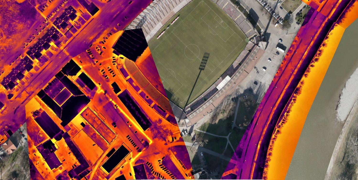
Thermal imaging of the heating distribution network from the air

JP Grijanje Zenica
Usluge
Dron services
Thermal inspection
Datum
March 9, 2023
Lokacija
Zenica
Thermal imaging is conducted using an unmanned aerial vehicle equipped with a thermal sensor. Flights are conducted at a specific altitude above the ground. The type of unmanned aerial vehicle used for thermal imaging is a quadcopter multirotor. The total length of the district heating pipeline is approximately 102 km.


