


Projects
Discover our expertly executed projects and trust us with the creation of your next endeavor.
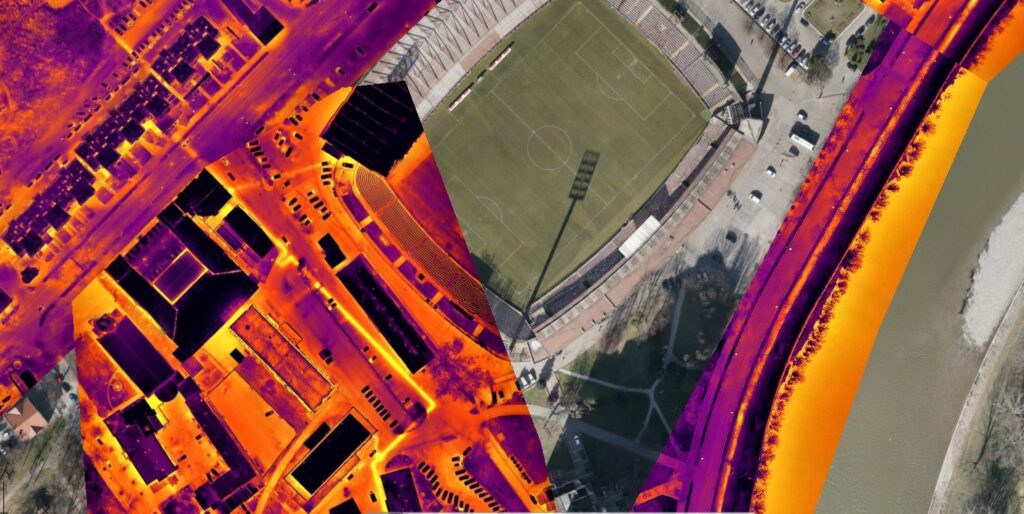
Thermal imaging of the heating distribution network from the air
Dron services
Thermal inspection
JP Grijanje Zenica
March 9, 2023
Zenica
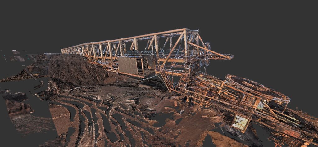
Crane scanning
BIM services
Cad to Bim
ArcelorMittal Zenica
March 8, 2023
Zenica

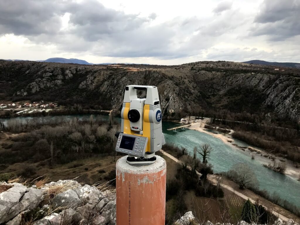
Geodetic monitoring of the Pehare Viaduct
Surveying services
Measurement and determination of displacements and deformations
Strabag
February 10, 2022
Zenica
Geodetic network for the construction of the Počitelj Bridge on Corridor VC.
Surveying services
Establishment and renewal of geodetic networks
Hering
February 9, 2020
Počitelj
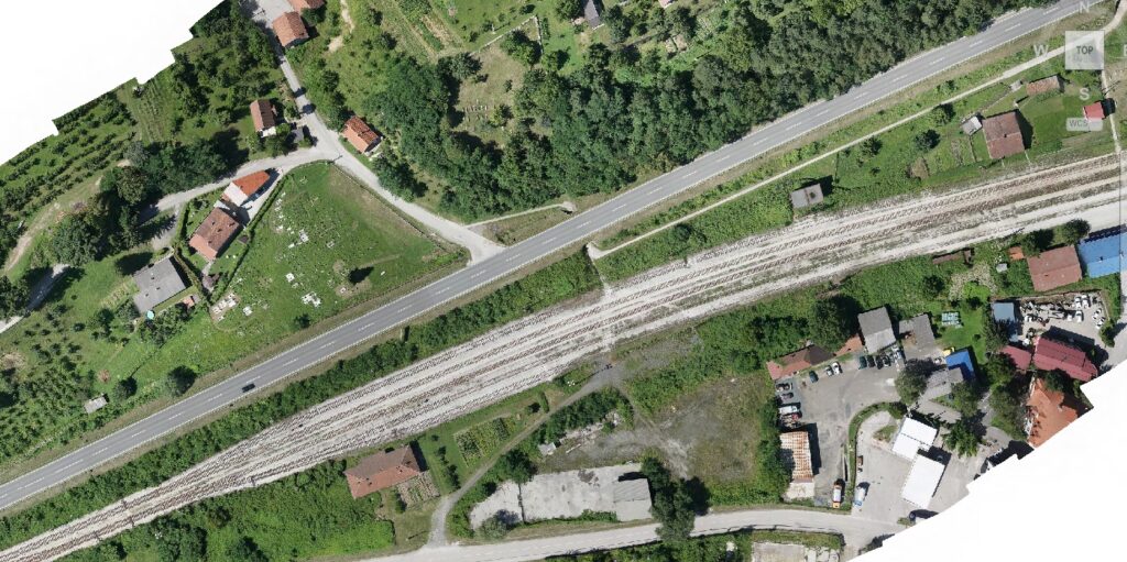
Creation of an orthophoto map for the M17 highway section Ozimice – T.Polje
Dron services
Aerophotogrammetric mapping
Mott MacDonald
August 10, 2020
Zenica
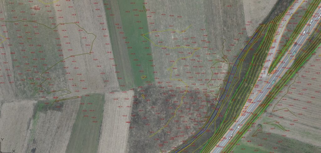
Creation of geodetic bases for the design of the highway section Putnikovo Brdo – Medakovo
Surveying services
IPSA Institut
March 8, 2019
Tešanj
Crane scanning
BIM services
Cad to Bim
ArcelorMittal Zenica
March 8, 2023
Zenica
Thermal imaging of the heating distribution network from the air
Dron services
Thermal inspection
JP Grijanje Zenica
March 9, 2023
Zenica
Creation of an orthophoto map for the M17 highway section Ozimice – T.Polje
Dron services
Aerophotogrammetric mapping
Mott MacDonald
August 10, 2020
Zenica
Geodetic monitoring of the Pehare Viaduct
Surveying services
Measurement and determination of displacements and deformations
Strabag
February 10, 2022
Zenica
Geodetic network for the construction of the Počitelj Bridge on Corridor VC.
Surveying services
Establishment and renewal of geodetic networks
Hering
February 9, 2020
Počitelj
Creation of geodetic bases for the design of the highway section Putnikovo Brdo – Medakovo
Surveying services
IPSA Institut
March 8, 2019
Tešanj


